Property boundary images
On NSW and VIC reviews, Curia attaches satellite images with property boundary overlays to the title reference and land address fields.
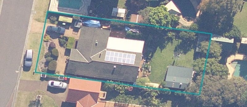
On a contract review, satellite images with the property boundary outlined in teal are attached to the title reference and land address fields. The images are generated from state government spatial data using the lot/plan details on the contract, and they ship in the client report alongside those fields.
Where the images sit
Each registered title gets its own image showing only that title’s boundary, and a contract with multiple titles has one image per title.
NSW NSW: details specific to New South Wales reviews
Each title’s image is attached to its Title reference field.
VIC VIC: details specific to Victoria reviews
Each title’s image is attached to its Title Reference (Volume/Folio) field.
A single combined image showing every title boundary together is attached to the Land address field, useful for contracts spanning multiple lots.
When there are no boundary images
A boundary image isn’t attached when:
- The title is unregistered or proposed (a plan of subdivision still being registered, for example).
- The lot/plan details are missing or couldn’t be parsed from the contract.
- State government spatial data has no record of the property - most often a new development where the boundary hasn’t been published yet.
VIC VIC: details specific to Victoria reviews
Curia also holds off when it can’t confidently match the property to a single parcel, rather than risk outlining the wrong one.
The title reference and land address fields still work normally in these cases - they just don’t carry an image.
Editing or removing the images
A boundary image behaves like any other field image once attached. You can:
- View it at full size by clicking the thumbnail.
- Edit it to add highlights or annotations.
- Add further images alongside it.
- Remove it from the field if you don’t want it in the report.